


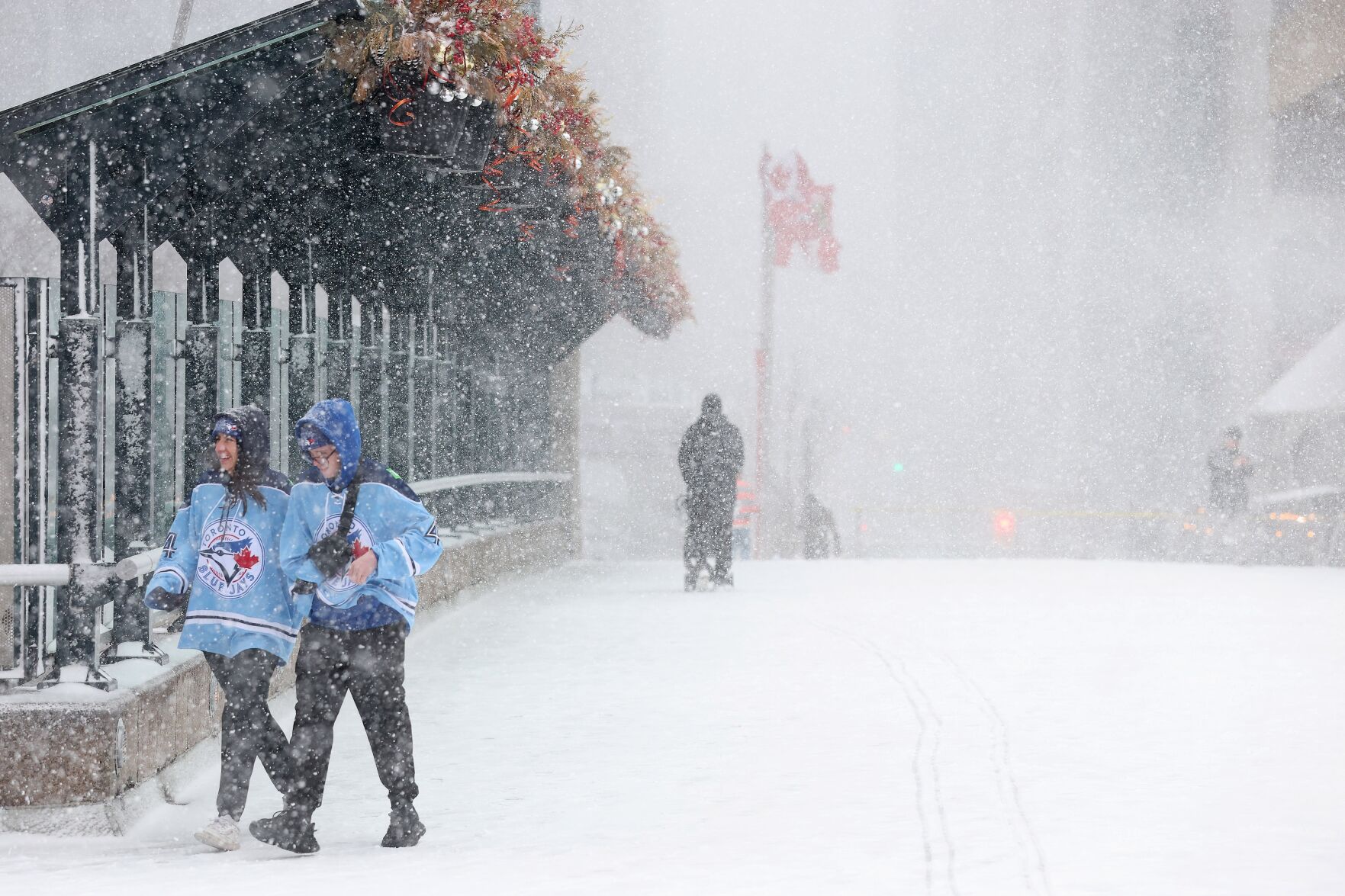
A significant storm began yesterday as snow barreled down on the city, with the Toronto forecast to receive up to 50 millimetres of rain by Thursday afternoon.
This file is no longer updating.
6:00 a.m. - Roads and highways flood in GTA
Persistent rainfall has flooded parts of major roads early Thursday morning, causing closures. The southbound Weston ramp to westbound Highway 401 and the Derry ramps to northbound Highway 427 are both closed, according to trafficnet.ca updates.
There is also significant flooding on northbound Highway 404 approaching westbound Highway 407, and in the area of Kennedy Road and Steeles Avenue.
7:20 p.m.: Environment Canada ends freezing rain warning for Toronto, rainfall warning persists
The freezing rain warning issued by Environment Canada for the city of Toronto has ended as the rainfall warning remains in effect.
Earlier in the day, Environment Canada warned that freezing rain would transition into rain in the evening.
The rainfall warning says that total rainfall amounts for Toronto will be from 30 to 50 millimetres, with locally higher amounts near 75 millimetres possible if thunderstorms repeatedly impact the same area.
The downpour is expected to end from west to east overnight into early Thursday morning, Environment Canada warns, adding that flash flooding is still possible.
Areas in the GTA and other parts of southern Ontario are still under a freezing rain warning.
6:30 p.m.: Pearson facing a number of delays in flight departures and arrivals
Toronto Pearson airport is advising of flight delays and cancellations for both arrivals and departures.
“The spring storm in the Toronto area has resulted in airlines delaying some flights today,” Sean Davidson, Toronto Pearson spokesperson, told the Star.
“Passengers should check the status of their flight with their airline,” Davidson said.
On the airline’s website, a number of delays and cancellations are listed for domestic and international destinations such as the U.S. and Mexico as of Wednesday evening.
A similar situation can be seen with arrivals, where several flights from Canadian and American cities are showing either a delayed or cancelled notice for inbound flights Wednesday evening.
4:55 p.m.: Worst ice storm damage since 1998, says Hydro One
Hydro One says this past weekend’s ice storm affected nearly one million customers, causing the most damage in the province since the 1998 ice storm.
Some of the challenges the electric utility company says they are facing include the widespread damage accumulated over several days and “multiple types of damage” that need to be addressed before power can be restored.
“Crews are out in full force working alongside our contractors and team members from 18 other Ontario utilities providing us with mutual assistance, and we expect more resources from our mutual aid agreements in the coming days,” Hydro One said in a news release, adding that around 192,000 customers remain without power.
Restoration continues throughout the week for areas hardest hit by the storm, “with most customers back online by the weekend.” Restoration is expected to take longer for more remote areas, according to Hydro One.
The electric utility company said that Wednesday’s storm may potentially slow down its efforts to continue restoring power, as high winds are causing additional scattered outages.
4:42 p.m.
By 4:30pm the snow had turned into rain in downtown Toronto, resulting in a messy and slushy commute home.
Jayden Wright, 26, came from Halton Hills to catch the Leafs play against the Florida Panthers but was caught off guard by the weather. He was at the corner of Bay and Front streets trying to catch a rideshare to grab some food before the game.
“It was snowing more up there but there’s more traffic here,” he says, wearing a Leafs jersey and no coat.
4:20 p.m.: Province deploying workers to help with ice storm emergency response
The Ontario government has sent workers and support resources to provide assistance to communities hit hardest by this past weekend’s ice storm.
The Ontario Corps, which is composed of skilled professionals and volunteers from various humanitarian aid organizations, has been deployed by the province.
To date, the government has provided over 2,000 wellness checks, 500 meals and distributed over 100 personal hygiene kits to communities without electricity, according to a news release from the provincial government.
Furthermore, the government says volunteers have contributed over 600 hours to the emergency response.
“I would like to recognize the incredible efforts of our emergency response personnel, Ontario Corps volunteers, hydro workers and first responders who answered the call to support their communities in times of need,” said Jill Dunlop, Minister of Emergency Preparedness and Response, in the news release. “Thanks to these efforts, we are on the road to recovery.”
As freezing rain continues to hit the province, the Ontario government reminds the public to prepare a three-day emergency kit and stay at least 10 metres away from downed power lines.
4:15 p.m.: Provincial police responding to dozens of collisions
The OPP says they are responding to about three dozen collisions in the Toronto area and GTA on Wednesday afternoon, including a closure on southbound Highway 400 due to jackknifed tractor trailer.
“If you’re on the roads, make sure you’re aware there could be flooding and ponding of water in low lying areas,” said OPP Sgt. Kerry Schmidt in a video posted on X on Wednesday afternoon.
“If you don’t need to be on the roads, wait for the system to pass and wait for crews to clear roads and make sure everything is in good shape,” Schmidt said.
4:05 p.m.
At Union Sation, snow has stopped and it is now lightly raining. There is a truck clearing some of the slush.
3:12 p.m. Transit updates
The 504 King streetcar is delayed between Dundas West Station and Broadview Station because of the weather conditions, adding to a list of TTC service adjustments.
The 64 Main bus is using alternate travel routes.
The 52 Lawrence West buses are delayed near Dixon Road and Islington Avenue East.

A commuter boards a TTC street car in Toronto’s west end.
Andrew Francis Wallace Toronto S3:10 p.m.
High winds combined with ice pellets means just standing outside feels like the one big apricot scrub session. If your jacket has a hood, or if you have a scarf or face mask handy, break them out.
A woman coming out of the subway declined to give her name, but when asked about a snowstorm in April she shrugged and said, “It’s Canada, we’re used to one last snow(fall) this time.”

A pedestrian uses an umbrella to fend off wet snow in Toronto.
Andrew Francis Wallace Toronto S3:00 p.m. City opens warming centres
Out of an abundance of caution, the City of Toronto is opening warming centres at 5 p.m. on Wednesday. Emergency centres intended to give people a place to rest, access food and use a washroom will be open at 136 Spadina Rd., 55 John St., 75 Elizabeth St., 12 Holmes Ave. and 885 Scarborough Golf Club Rd.

A person clears snow off their car at a parking lot at Spadina Ave. and Front St. in Toronto.
Lance McMillan Toronto Star2:45 p.m. Shoppers brave the storm
The roads around Don Mills and Sheppard are quieter than usual, as high winds and snow are prompting any motorists to slow down to avoid collisions. Inside Fairview Mall it feels as though it’s business as usual with mall walkers making the rounds, people hanging out in the common areas and lookers, but not many buyers, at the Bay’s closing sale.
-Karon Liu
2:15 p.m. Pearson asks travellers to check ahead
Toronto Pearson International Airport put a “traffic management initiative” in place and told travellers to check the status of their flight with their airline. Dozens of departing and arriving flights have been delayed.
Spring snow is falling at the airport. Here’s a look at the airfield this afternoon where a Traffic Management Initiative has been put in place. ⁰⁰Passengers should check the status of their flight with their airline. pic.twitter.com/lKmh1VkKOk
— Toronto Pearson (@TorontoPearson) April 2, 2025
1:45 p.m. Was that ‘thundersnow’?
By midday Wednesday, some X users began reporting thundersnow and extended rumbles of thunder across parts of Southern Ontario.
Thundersnow is a rare winter phenomenon when, instead of rain, snow is the main precipitation during a storm. Like thunderstorms, thundersnow includes thunder and lightning — usually in flashes of blue due to the high concentration of ice crystals in the air. However, the snow typically dampens the sound of thunder.
You can read more about thundersnow in our explainer from 2023 here.
just got some thundersnow near kw! #onwx #onstorm #wxtwitter pic.twitter.com/58koG7q7us
— aaron 🌪️ (@awrooWX) April 2, 2025
1:30 p.m. Snow makes a surprising appearance
Environment Canada is forecasting periods of snow or ice pellets in the afternoon, with a risk of a thunderstorm early this afternoon. The agency says the local snow and ice pellet amount is expected to be around 2 centimetres.

As climate change worsens storms, many people don’t realize they’re in a flood-risk area. Use
11 a.m. TRCA warns of flooding risks
Heavy rainfall could cause water levels to change quickly according to a flood notice from the Toronto and Region Conservation Authority, posted Tuesday afternoon.
Between melting snow and ice, the forecasted rain and already saturated ground, water may begin to pool in places across the city or create slippery and unstable banks.
“All shorelines, rivers, and streams within the GTA should be considered dangerous,” the organization warned. “Avoid all recreational activities in or around water at this time, including fishing, canoeing, hiking, etc... Please exercise caution if you must be around any bodies of water, rivers or streams as well as the Lake Ontario shoreline... Avoid driving through ponded areas or underpasses with deep water.”
The GTA was expected to get up to 50 millimetres of precipitation into Thursday when temperatures were forecast to rise to 19 C.
The GTA was expected to get up to 50 millimetres of precipitation into Thursday when temperatures were forecast to rise to 19 C.
City of Toronto crews have cleared basins in low-lying areas and have been proactively removing debris from roads — including “extensive” street sweeping — to help prevent flooding.
Residents can report a blocked catch basin, road flooding or basement flooding through Toronto 311.
The TTC is ready to divert any routes along the lake if they begin to flood. If the weather turns to freezing rain, the transit organization will implement its “winter weather plan” which includes adjusting service, using anti-icing sprays and salting tracks and the ground near stations.
8 a.m. Freezing raining warning added
Before the heavy rainfall in the afternoon, Environment Canada posted a warning for freezing rain that is expected to begin later in the afternoon. It’ll transition into rain in the afternoon.
The agency said short periods of freezing rain happening in the morning or afternoon could cause minor ice accretion, making highways, walkways, parking lots, and roads slippery.

A pedestrian battles the weather walking along Shuter street near Sherbourne. Snow, rain, sleet and wind combined in Toronto on Wednesday afternoon. Pedestrians and drivers alike found it difficult to navigate the streets.
Richard Lautens Toronto StarEnvironment Canada re-posted its rainfall warning Wednesday morning saying the heavy rainfall will begin later in the afternoon and taper off on Thursday morning, amounting to about 30 to 50 millimetres. The agency says this amount could be higher depending on the severity level of thunderstorms later tonight.
5 a.m. Heavy rain, thunderstorms to hit Toronto
Rain is expected to start falling Wednesday morning over southwestern Ontario, reaching the Golden Horseshoe by Wednesday afternoon.
“With thunderstorms expected, rainfall amounts may exceed 50 mm over some areas, particularly over southwestern Ontario,” Environment Canada said.

A person sits calmly in the storm in Moss Park Snow, rain, sleet and wind combined in Toronto on Wednesday afternoon.
Richard Lautens Toronto StarThere is the risk of localized flooding in low-lying areas, the agency added.
The special weather statement comes as much of the province is still cleaning up from a major weekend ice storm that downed trees, halted transportation and left hundreds of thousands without power.

Winter floods aren’t common in southern Ontario, but can happen when temperatures fluctuate —


To join the conversation set a first and last name in your user profile.
Sign in or register for free to join the Conversation